
What is Spatial Data and Non-Spatial Data?


Spatial data, also known as geospatial data, is a term used to describe any data related to or containing information about a specific location on the Earth’s surface. Non-spatial data, on the other hand, is data that is independent of geographic location. This blog post will highlights the basics and difference between both spatial and non-spatial data.
Why should you care? Geospatial data can help you make better decisions by leveraging the power of spatial relationships. Making sense of its differences will help you make even better decisions and expand your knowledge of data too.
The Basics
Spatial data can exist in a variety of formats. It can also contain more than just location specific information. To properly understand and learn more about spatial data, there are a few key terms that will help you. Head on over to this article for acronyms that you may come across. The following types of data exhibits spatial locality:
Primary Spatial Data
Vector
Vector data is graphical representations of the real world. There are three main types of vector data: points, lines, and polygons. Connecting points create lines, and connecting lines that create an enclosed area create polygons. Vectors present generalizations of objects or features on the Earth’s surface. Vector data and the file format known as shapefiles (.shp) are sometimes used interchangeably. Vector data is most often stored in .shp files.
Raster
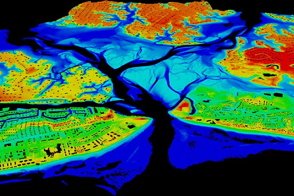
Raster data is data that is presented in a grid of pixels. Each pixel within a raster has a value, whether it be a colour or unit of measurement. This communicates information about the element in question. Rasters typically refer to imagery. However, in the spatial world, this may specifically refer to orthoimagery which are photos taken from satellites or other aerial devices. Raster data quality varies depending on resolution and your task at hand.

Secondary Spatial Data
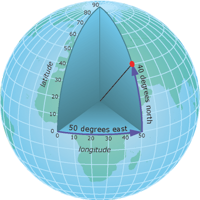
Geographic Coordinate System
To identify exact locations on the surface of the Earth, a geographic coordinate system is used. Normally, an x and y-axis are used in mathematical systems, but in geography, the axes are referred to as lines of latitude (horizontal lines that run north-south) and longitude (vertical lines that run east-west). Each axis represents the angle at which that line is oriented with respect to the center of the Earth, and so the units are measured in degrees (°). There is more on projections and coordinate systems below!
Georeferencing and Geocoding
Georeferencing and geocoding are different. However, they are similar processes. Both involve fitting data to the appropriate coordinates of the real world. Georeferencing is the process of assigning coordinates to vectors or rasters so they can be oriented accurately on a model of the Earth’s surface. The data used in geocoding are addresses and location descriptors (city, country, etc.). Each of these locations is given the coordinates of reference for that location on the surface of the Earth.
Additional Types of Spatial Data
Attributes
Any additional information, or non-spatial data, that describes a feature is referred to as an attribute. Spatial data can have any amount of additional attributes accompanying information about the location. For example, you might have a map displaying buildings within a city’s downtown region. Each of the buildings, in addition to their location, may have additional attributes such as the type of use (housing, business, government, etc.) and how many stories it has.
LiDAR and 3D Data
In addition to raster and vector data, there is also LiDAR data (also known as point clouds) and 3D data. LiDAR data is data that is collected at different points and measuring the return times for reflected light. This infers distance and eventually a 3D position. 3D data is data that extends the typical latitude and longitude 2-D coordinates. It incorporates elevation and/or depth. While complex, this data is rich with information. 3D data can be used to solve a variety of problems pertaining to the Earth’s surface.
More Spatial Data
Not limited to the outdoor environment, there are many architectural, engineering, and construction (AEC) companies that use CAD (computer-aided design) and BIM (building information model) data day to day. While CAD and BIM may not be thought of as traditional spatial data, they and other AEC formats need to consider many spatial elements to understand their work.
Mapping is also no longer limited to the natural world. Indoor mapping and wayfinding are becoming popular. This is especially true in large buildings and institutions like malls, arenas, and campuses.
Non-Spatial Data
Non-spatial data, simply, is data that contains ‘what’ instead of ‘where’. As mentioned above, it is independent of geographic location.
An attribute could contain both spatial and non-spatial data. Non-spatial data can help put spatial data into more context. It is characteristic data. This could be someone’s height, for example. It has nothing to do with their location. The difference in structure is highlighted in the image below.

You might also want to read:
Navigating Non-Spatial Data Migration
FME and Spatial Data
FME for Spatial Data Integration
While there are many tools and software that can help you make use of spatial data, FME is the software of choice for those that need to integrate their spatial data. Safe Software and FME came into existence to solve this problem. Spatial data varies widely. It is often stuck in formats that cannot be easily used by all applications. This makes it extremely difficult for GIS experts to make use of all the information they have. While it was possible to transform proprietary formats in the past, much of the data would be lost in the conversion. Thus, FME was born.
With a greater ability to connect and transform your data, you’ll be able to solve data challenges more effectively and efficiently. Learn more about FME today!
Explore more blog content headline

Data-Driven Marine Operations: 5 Ways to Generate Actionable Insights from Ship to Shore


Introducing FME Form 24.0: Redesigned User Experience for Focus and Consistency


[New!] AI Assist in FME: How to Build Better Data Integration Workflows with the Help of AI