Infrastructure asset management can be complex and involve a lot of incompatible data formats and standards. Data integration workflows help to harmonize systems and keep information clear through all phases of infrastructure design, management, and maintenance. Let’s look at 4 ways data integration workflows improve infrastructure asset management with some inspiring, real-world examples from cities, utility companies, and other facilities around the world.
1. Complying with standards
Infrastructure asset management data usually needs to comply with CAD and civil submission standards. It also needs to meet internal standards for data quality and robustness. Layer names, attribute names, geometry, and other aspects of a dataset have to be checked and repaired.
Using an FME data integration workflow means infrastructure asset management data can be automatically validated against complex standards. It can then go on to repair data and generate a Quality Assurance report which is automatically emailed to stakeholders. Many companies use FME to create a self-serve data validation portal where users can submit datasets in a web interface and get back a QA report.
When working with infrastructure asset management, data validation workflows often include converting models to specification through transformations like schema mapping, simplification, geo-referencing, extruding footprints to 3D, and working with appearances and textures.
Example: Complying with CityGML standards for 3D building models
Applied Geographic’s worked with New York City’s DoITT to create a 3D model for the city’s 1 million buildings. They used FME to transform the data so it complies with OGC CityGML specifications. The resulting 3D dataset offers an innovative new way to model and analyze the city. Learn more about this AppGeo project to create 3D CityGML models of NYC.

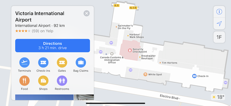
Victoria International Airport created an interactive indoor map by integrating floor plans and facility information from Geodatabase and transformed it to meet IMDF (Indoor Mapping Data Format) standards. The FME workflow used geo-referencing, schema mapping, validation, and format conversion. Not only does this help passengers navigate the airport, but it also helps airport staff track changes to the infrastructure. Learn more about YYJ’s indoor mapping project.
2. Asset handover and data delivery
Converting data into other formats is often necessary through all phases of a project. Anything from asset handover, delivering as-builts, generating digital assets and packages, to other requirements for sharing and collaboration. When multiple teams and stakeholders are involved in a project, data often has to be viewable in an easy-to-share, interactive way.
An FME data integration workflow can be built to automatically convert data to endpoints like CAD, GIS, 3D PDF, an interactive model for viewing in a web browser, virtual reality, augmented reality, and hundreds of other formats.
Scenario: Sharing facility data across departments
Denver International Airport manages Revit and Civil 3D models that change daily due to active construction projects. FME is used to automatically update the models and convert them to endpoints like GIS, PDF, and AutoCAD, so up-to-date data models can be shared across departments. They also integrate floor plans, assets, and infrastructure to generate an interactive online map for staff and passengers. Learn more about Denver airport’s data integration projects.
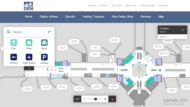
accessible for staff and passengers.
3. Combining disparate sources for a unified data model
Asset handling often involves gathering data from different teams and systems—Autodesk, Bentley, Esri, IFC, Excel, indoor maps, and many other types of data are common. When data comes from disparate sources, it’s important to integrate them into a common view or environment so information is harmonized and up to date. A complete view of the data means meaningful insights can be made.
Aggregating data into a warehouse or centralizing it into a unified data model is the essence of data integration and can be achieved with a repeatable FME workflow.
Scenario: Integrating data across 20+ organizations to rebuild a city
After a series of devastating earthquakes in Christchurch, NZ, the infrastructure rebuild team (SCRIT) used FME to integrate and analyze data from many disparate sources. Data was acquired from 20+ organizations and integrated into a 600+ layer GIS, which was then used for damage assessment, design, construction, collaboration, and more. Learn more about the Christchurch rebuild project.

Ponderosa Telephone saved hours of manual conversions every day by automating them for telecom infrastructure data. For example, a workflow is used to convert AutoCAD to SQL Server Spatial on an automated schedule. FME is also used to perform GIS analysis and processing on the fly, eliminating the need for an external GIS. Learn more about Ponderosa’s data integration workflows.

4. Automating infrastructure asset management to save time and money
A common thread through all of these examples is automation. Self-serve data upload or download applications, sending reports, keeping systems synchronized and data warehouses up to date, and more, all rely on automation to operate efficiently. Automation frees up time for people to work on other tasks.
Data integration workflows are built once in FME Workbench, and then used in an Automation in FME Server. The nature of an Automation is that when an event happens—say when a new file arrives in a directory, an email is received, or on a schedule—an FME Workspace is triggered and actions are taken based on the results.
Scenario: Automated risk assessment for natural disasters
Powerlink Queensland uses FME to monitor for warnings about severe weather events, analyze risks and impact to their high-voltage electricity transmission network, and send reports to stakeholders when infrastructure are at risk. The reports are sent in accessible formats like PDFs with layered maps, enabling quick and efficient decision making while reducing the time spent managing and analyzing emergency events. Learn more about Powerlink Queensland’s automated emergency management system.
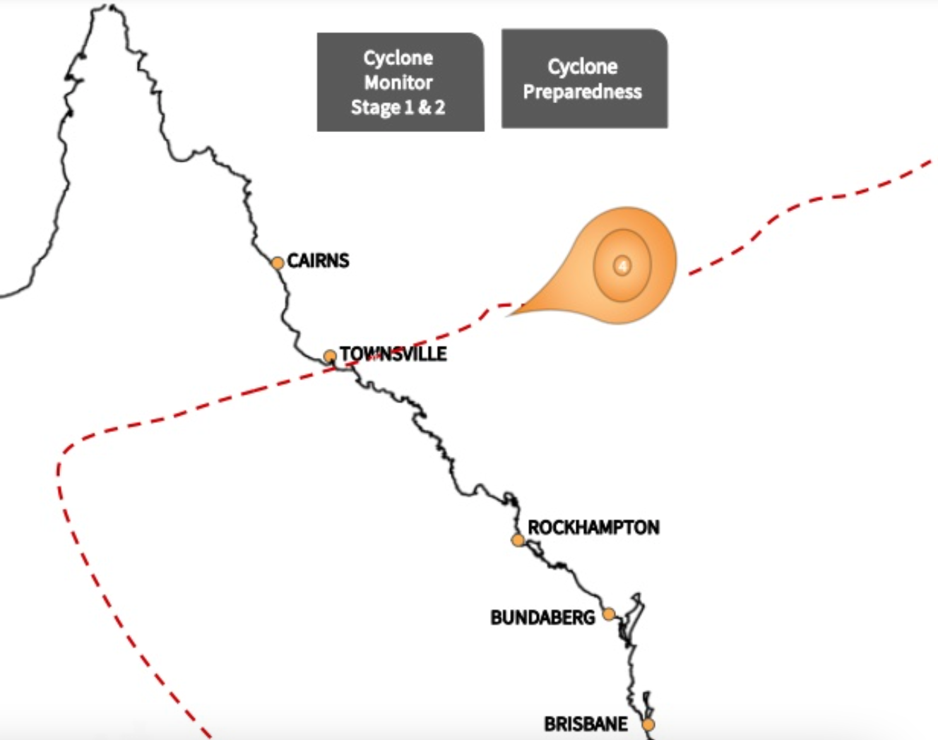
and analyze the impact of natural disasters.
Tesera Systems created a web app that municipalities can use to identify risks to infrastructure. The FME-powered web app processes their submitted GIS data and outputs models that are then analyzed with machine learning algorithms. The workflow helps predict the risk of a sewer backup, which enables the municipality to take action to improve infrastructure or develop flood emergency plans. Learn more about Tesera Systems’ web application.
*Data integration workflows help facilitate how information moves through all phases of project lifecycles. Whether infrastructure asset management is being planned, built, or maintained, it’s important to harmonize data across teams and systems and automate the process to free up time and save money.
Wondering how to get started?
- Download a free trial of FME and start building data integration workflows to manage your infrastructure and assets.
- Sign up for a customized one-on-one FME demo that’s tailored to fit your infrastructure and asset needs.
- Learn more by watching one of our related Webinars: 8 Ways Utility Networks Can Meet Data Demands, Planes, Trains and Automobiles – Handling Infrastructure Assets with FME or reading our blog posts like FME 2016 Sneak Peek: Attribute Management
We look forward to helping you conquer your data!

Tiana Warner
Tiana is a Senior Marketing Specialist at Safe Software. Her background in computer programming and creative hobbies led her to be one of the main producers of creative content for Safe Software. Tiana spends her free time writing fantasy novels, riding her horse, and exploring nature with her rescue pup, Joey.