When a land developer submits a CAD plan, the municipality’s GIS team has to enforce data standards, ensure the submission contains all necessary information, and bring it into their GIS. This can be a tedious, manual process. Let’s talk about the benefits of an automated digital submission service. This can be implemented as a single workflow that uses 3 key steps, then set to run automatically on a web page or app, freeing the GIS team to work on other tasks.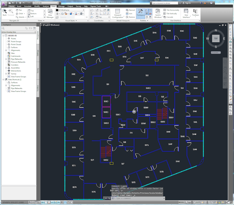
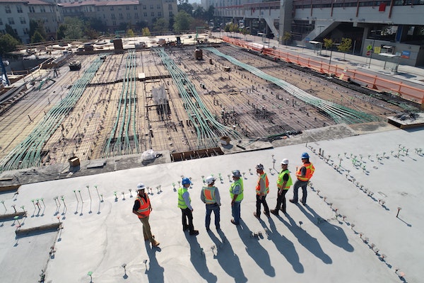
AutoCAD DWG floor plan for a new high-rise.
Step 1: Perform Data Validation to Enforce Standards and Guidelines
Every municipality is different in terms of its landscape and topography, infrastructure, population, and other parameters, and so every city has a unique set of data standards. For example, here in British Columbia, all infrastructure designs should comply with the Master Municipal Construction Documents (MMCD).
But it isn’t safe to assume that everyone is going to comply with municipal standards, even if there are bylaws in place. Developers, consultants, engineers, surveyors, and organizations also have their own standards and practices. So how do you enforce compliance without spending hours manually checking the data? Often, every component has standards to comply with – right down to each valve. Manually checking for compliance is tedious, time consuming, and risks human error.
This is why data validation is the first step when a digital submission is received. When data is submitted, you can trigger an FME workflow to validate all submissions against your municipality’s standards, then generate a report indicating the success or failure. The submitter can use the QA report to fix their dataset so it complies with standards before re-submitting it.
This has the advantage of putting the responsibility of making corrections onto the person submitting the dataset – a practical expectation that frees up time and effort for the GIS team.
- Demo: Try this CAD Validation portal and learn how it was made in this tutorial.
Here you can also perform quality checks on the topology, layers, assets, and any other rules you want to enforce, like ensuring meters exist wherever there’s water. To learn more about how to perform data validation and quality assurance in FME, check out these resources:
- [Tutorial] Data Validation and QA with FME
- [Tutorial] AutoCAD Validation and Quality Assurance
- [Blog] FME and Digital Data Checking: 9 Transformers for Automated Validation
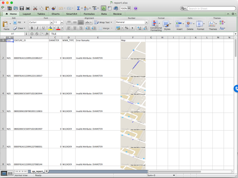
A data validation report generated by FME that lists errors in a submitted dataset.
If the validation is successful, the data can be passed on to step two in the workflow.
Step 2: Integrate the CAD Submission with the Municipality’s GIS
When the GIS team receives a submission, it needs to be analyzed and imported to the central data repository. This is where an automated workflow to bring CAD layers into GIS is helpful.
This step of the workflow involves ensuring all infrastructure, like water mains, sewer mains, drainage, and power lines, fit with the municipality’s GIS.
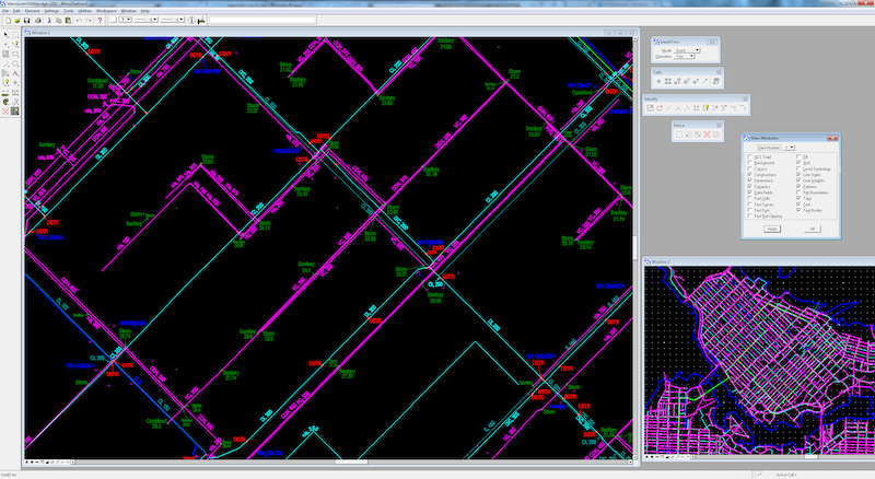
MicroStation DGN data showing utilities.
We have a blog about how to convert CAD to GIS without losing data integrity, where we cover topics like how to map CAD assets to GIS attributes, plus how to maintain the integrity of other complex CAD elements.
Step 3: Keep CAD and GIS Data Synchronized
Connecting CAD submissions with your organization’s GIS repository is important at all phases of a project, including design, engineering, and construction. Consider the following steps:
- Surveyors submit a plan in the form of a cadastral legal survey.
- Once approved, an infrastructure design is created, including drainage, roads, etc.
- Construction begins, which results in an as-constructed drawing.
- Engineers submit an as-built drawing.
Throughout this whole process, the drawings and designs are in a CAD format, and the information needs to stay connected to the municipality’s GIS. Keeping these synchronized at every stage of a project will save teams a lot of time and reduce the risk of discrepancies.
A municipality can ensure submitted CAD data stays synchronized with the GIS by setting their data integration workflow to launch whenever a plan is submitted or modified. Use the FME Server Automations interface for this.
Problem Formats
Of course, for a submission portal to work, the submitted data needs to be in a digital CAD format, like AutoCAD or MicroStation. Unfortunately, developers often use more complicated formats for this information:
- Paper. CAD plans often arrive in paper format and are marked up by each department.
- PDF. This format is fine if you just need to share a snapshot of data, but it isn’t functional for analysis or integration. You can’t work with data stored in a PDF any better than you can work with a paper plan.
While it’s best for developers to create plans in CAD software from the beginning, FME has tools to help you gather information if you’re stuck with paper and PDF formats. Check out our resources on vectorizing rasters and edge detection in rasters, as well as our PDF reading blog and tutorial for tips on extracting geospatial data from PDFs.

Paper and PDF drawings complicate the process of automatically converting CAD submissions to GIS.
Beyond Digital Submission Workflows
Using a digital submission service to accept CAD plans saves a GIS team time, effort, and reduces errors and discrepancies. When a plan is submitted, the workflow to validate the data against standards and bring it into the GIS is triggered automatically, and any errors are compiled into easy-to-read reports.
The benefits of using data integration workflows extend beyond CAD-GIS conversions. With automated data integration, information can be synchronized across departments and systems, including finance, work order management, asset management, business intelligence, CityWorks, and more. Teams can coordinate easily because everyone has access to the same up-to-date dataset. Data pertaining to the same project can be harmonized across systems, e.g. fire hydrant data can be contained in a single infrastructure drawing that is available to emergency services, city workers, and the public via a portal. It becomes easy to integrate other data types and to identify contributing factors to new infrastructure, like soil conditions, trees, and other environmental considerations. Intelligence and creativity are facilitated, paving the way for innovative projects.
Check out this blog on 8 Ways Local Governments Can Improve Operations Using Data Integration for more ways municipalities are using FME in their day-to-day activities.
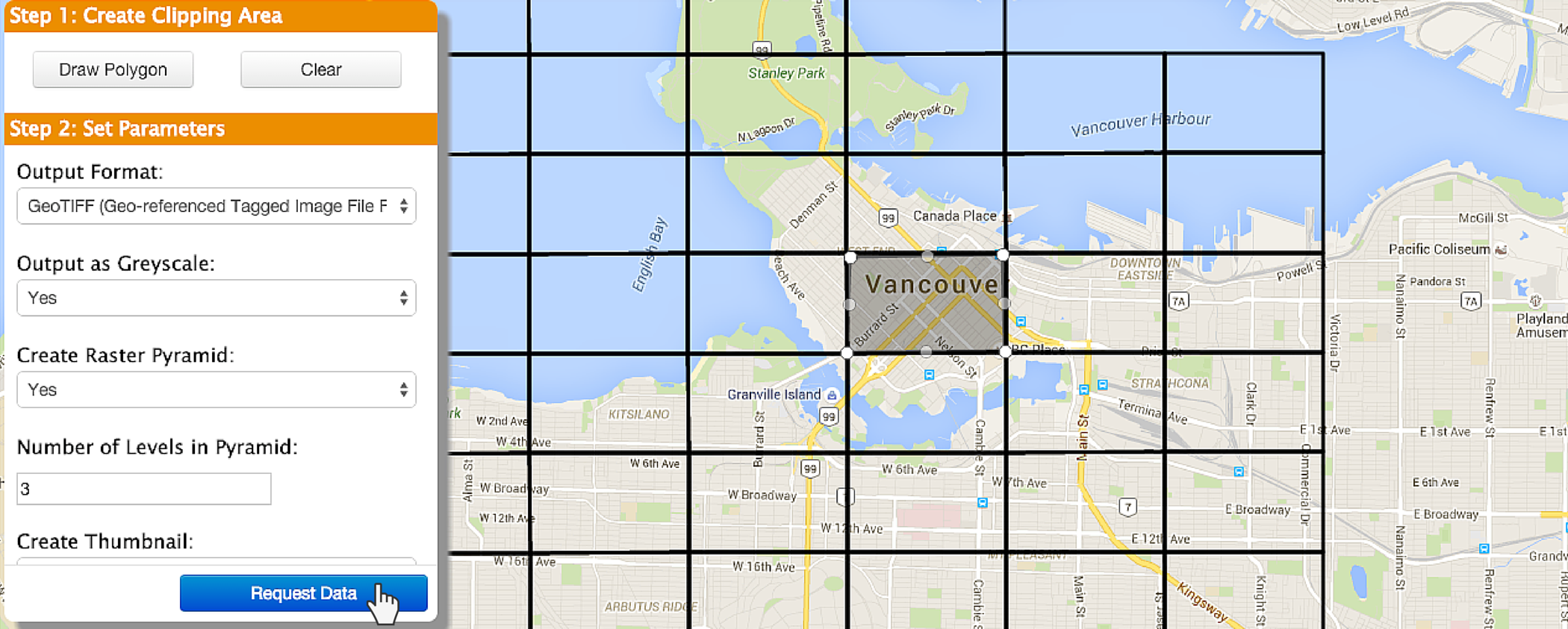
Once data is stored in the central GIS repository, the municipality can make it available so anyone can choose what as-built drawings they want to see by drawing an area on a map.
This can be useful for Before You Dig services, open data portals, and more.
Case Study: City of Henderson
The City of Henderson uses FME for automated CAD to GIS conversions and validation, enabling their automated digital plan submission process for new construction projects. Read more in our customer gallery and in this blog post by our partner, Consortech.

By automatically validating plan submissions and integrating them with the municipality’s GIS, teams can save time, resources, and enable sophisticated data processing across the organization. Plus, the workflow can scale up to meet demand without any extra effort on your part.
This is just one of many ways that governments around the world are using data integration workflows. Learn about other use cases, like open data portals, application integration, and more, and check out our Local Government Subscription Pricing to learn how you can get started with FME.
Special thank you to Karen Stewart for providing me with information about this process.
To learn more about the power of automated data integration workflows for CAD and GIS, join us on our upcoming webinar, How to Automate CAD & GIS Integration on May 13, 2020 and read 3 Tips for Total CAD-GIS Integration.

Tiana Warner
Tiana is a Senior Marketing Specialist at Safe Software. Her background in computer programming and creative hobbies led her to be one of the main producers of creative content for Safe Software. Tiana spends her free time writing fantasy novels, riding her horse, and exploring nature with her rescue pup, Joey.