Where does Esri’s Community Maps Program Fit In?


Base maps are integral to GIS, allowing us to give our own data context. There are many options as to where you can source your base map, ranging from full commercial offerings to open source. What I want to explore is where the new Community Maps Program from Esri fits in and under what circumstances you might consider participating in the program.
First, here’s a quick overview of the potential data sources for base maps:
-
Commercial
Commercial companies such as Navteq/TeleAtlas sell data directly and many of the web-applications that people use, such as Bing, are powered by commercial data sources.
While not a true source of data for your GIS, Google are also worth a mention. Google used to get their data for Google Maps from commercial sources but in 2009 switched to using their own data in parts of the world. Exactly where the data came from is unclear (if you know, please comment), but questions about the accuracy of the data have been raised.
To help improve the data as a good geospatial citizen you can either:
- Submit corrections to the data using Google Map Maker.
- Submit your own authoritative data through the Base Map Partner Program map which appears to essentially grant Google a license to use your content.
-
Government
Depending on your location, you may have access to state/national data. For example, in the UK you can obtain high quality base data through the Ordnance Survey. This is free for government agencies but costs for private organizations (at least it was a few years ago).
-
Open Source
The OpenStreetMap project provides a base map that is truly open and was created by community members. We’ve also written about OSM a few times in the past.
How Does Esri’s New Offering Compare?
Reading this you would think the market is already quite crowded. So where does the new Community Maps project fit in? Well even though the commercial offerings and OpenStreetMap project are mapping the same thing, in-reality they are two completely different products. The commercial offerings offer value to their customers by ensuring the content is accurate and trustworthy (so called authoritative data). OpenStreetMap on the other hand while free, does not validate the accuracy of the data submitted and as a result cannot be used in many situations (i.e. If you are routing emergency vehicles then the accuracy of the data is everything and worth paying for). The Community Maps Program aims to bridge the gap by offering data with the same quality of the commercial offerings, but with the added benefit of being able to use it for free.

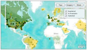
So how do Esri plan on doing this? What Esri realised (similarly to Google) is that some of the highest quality datasets that exist were created by local/national governments, especially in the USA. The program is about selectively taking these high quality datasets and integrating them into the base maps managed by ArcGIS.com, namely the beautifully constructed World Topographic Map. Their aim therefore is to provide an authoritative dataset which can be trusted and that can be used for free.
While the dataset is free to use (not free in the OSM sense), there are a few caveats. Namely, you can only access the data through ArcGIS 9.3 or higher, the ArcGIS API’s, or ArcGIS.com. So if you are using different software then it might not be the program for you. For that situation, Esri would need to serve it up through a WMS so you can add it as a base map into any application.
 For details on how you go about migrating your data into the Community Maps, check out Steve Grise’s post where he describes how he used FME to perform the migration. Steve also recently presented a webinar with my fellow blogger, Dale Lutz, and the recording from that webinar can be watched here.
What are the current sources of data for your base map? Will you be contributing your data to Esri’s Community Maps Program? I’m very interested in hearing your reasons on why or why not, so please do share.


