By now you are no doubt aware of the massive oil leak a mile beneath the surface of the Gulf of Mexico. The quickly spreading oil slick has the potential to do serious damage to sensitive wildlife areas, and crews led by both BP and the US government have been working hard to contain the damage and stop the leak. Thanks to the efforts of the geospatial community during these types of disasters, the public now has a much better understanding of these situations and their impacts.
Lots of Data
There are a number of organizations releasing data that is helping paint a relevant picture for the public. Data has been coming in from numerous sources, often in different formats or schemas. For example, The Louisiana State Government has been releasing official data in KML and PDF and the US Minerals Management Office has some regional background data in E00.
A few groups have been attempting to pull as much public data as they can into a single place, which is great given how many different places someone would need to look to get this data otherwise. Google especially seems to be doing a great job taking this data and presenting it in KML, which everyday people are familiar with and can actually comprehend.
Applications Being Built on the Data
Aside from Google, other individuals and groups have been building applications on top of the data to help the public gain a better understanding of a wide range of issues. Here’s two examples. 
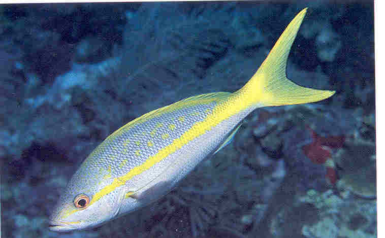
- If you’re wondering what impact the oil spill may have on your favourite tropical fish, Geocommons has created several maps, one of which shows the “Oil Spill Impact on Yellow Tailed Snapper”.
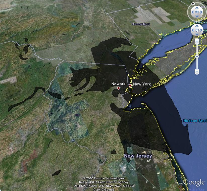
 If you’re interested in the relative size of the oil spill, Paul Rademacher has created a tool to overlay a KML file of the oil spill over any city (requires Google Earth browser plugin), which I found useful, as I don’t have a concept of how large the Gulf of Mexico is, but know quite well how large Vancouver and New York are.
What About the Future?
Perhaps we’ll soon have access to centralized open-data clearing houses, run by government organizations that will distribute data in a way that both professionals and everyday people can use and make sense of.
In this regard, the state of Arkansas is leading the way and even has plans for disasters should something like this happen that would increase the demand for this type of data. In the mean time it’s good to see others pulling this information together to allow applications to be built that keep the public informed.
Which applications have you found helpful? Feel free to add to the list, or share your thoughts.
Michael Weisman


